
Jomolhari
Trek
Base Camp of the Sacred Mountain · Paro to Thimphu
A Journey to the Sacred Mountain
The Jomolhari Trek is one of the most celebrated high-altitude trekking routes in Bhutan — and arguably the finest introduction to the country's wildest landscapes. Starting from Drukgyel Dzong at the northern end of the Paro Valley, the route follows the Paro Chhu river northward into increasingly remote terrain, climbing toward the base camp of Mount Jomolhari (7,326m), one of the most sacred peaks in the Bhutanese Buddhist tradition.
The mountain — whose name translates roughly as "Lady of the Mountain" — is believed to be the abode of a fierce female deity and has never been summited. To stand at its base camp and look up at those sheer, glaciated walls rising nearly 3,000 metres above you is one of the most humbling experiences available to a trekker anywhere on Earth.
Beyond the mountain itself, the Jomolhari Trek passes through landscapes of extraordinary variety — subtropical forest in the lower Paro Valley, wide yak-grazed meadows above the treeline, ancient fortress ruins at Jangothang, turquoise glacial lakes, and remote high-altitude passes. You will spend nights in tented camps under skies brilliant with stars and wake to the sound of yak bells and the distant calls of ravens echoing off the peaks.
The trek typically ends either by returning the same way or continuing over the Bhonte La pass and descending to Thimphu via Lingshi Dzong — a dramatic and immensely rewarding extension that adds 2–3 days and turns the route into a true traverse.


Jomolhari Trek Itinerary
A classic 9-day route to Jomolhari Base Camp and back. Extensions to Thimphu via Lingshi are available — ask our team for details.
Your trek begins with a drive to the ruins of Drukgyel Dzong at the northern end of the Paro Valley, a 17th-century fortress built to repel Tibetan invaders. From here the trail enters the Jigme Dorji National Park and follows the Paro Chhu river upstream through farmland, blue pine forest, and apple orchards. The first camp at Sharna Zampa is a gentle introduction — a grassy riverside clearing with the first distant glimpses of high snowy peaks ahead.
A longer day as the valley narrows and the trail climbs more steeply. You pass through several abandoned settlement areas and cross a series of wooden bridges over the Paro Chhu. The forest gradually gives way to open meadows as the altitude increases. Your first glimpse of Jomolhari's white pyramid appears above the valley head — a sight that quickens every trekker's pulse. Camp at Thangthangkha in a wide meadow beneath towering ridgelines.
The most dramatic day of the trek — as you round the final bend and Jomolhari comes into full, overwhelming view. The sheer south face of the mountain dominates the entire horizon, its glaciers glinting blue-white in the sun. The ruins of Jangothang Dzong stand sentinel on a ridge above the valley, adding a layer of ancient human history to this wild landscape. Camp here for two nights to acclimatise properly to the altitude.
A rest day at base camp — but far from idle. Spend the morning exploring the ruins of Jangothang Dzong, a 17th-century fortress abandoned after repeated flooding. In the afternoon, walk up to the ridge above camp for panoramic views of Jomolhari, Jichu Drake (6,989m), and the Tsophu Lakes — a pair of sacred glacial lakes set in a cirque beneath the peaks. Yak herder families often camp nearby and are happy to share butter tea with passing trekkers.
The highest and most demanding day of the trek. The trail climbs steeply from base camp to the Nyele La pass at 4,890m — the highest point of the route — where prayer flags stream in the cold mountain wind and the views extend across an ocean of peaks in every direction. The descent to Lingzhi is long and knee-testing, but the valley below rewards you with the spectacular Lingzhi Dzong perched on a cliff above the settlement. An unforgettable day.
A well-earned rest after the gruelling pass crossing. Spend the morning visiting Lingzhi Dzong, one of the most dramatically positioned dzongs in Bhutan — perched on a rocky promontory with sheer drops on three sides and panoramic mountain views. The surrounding high-altitude valley is home to bharal (blue sheep), which can often be spotted on the hillsides above camp with binoculars.
The return journey begins with a traverse through the remote Chebisa village — one of the most traditional and least visited communities in western Bhutan, where stone houses cluster around a small temple and a waterfall cascades down the cliff behind the village. A family of black-necked cranes often overwinters in the Chebisa valley — look for them in the fields. Camp at Shodu, a tranquil riverside meadow.
A varied day of trekking through high pastureland, with extensive views back toward the Jomolhari massif. The trail passes through Robluthang — a wide, flat valley used as summer pasture by yak herders from Haa — before climbing gently to the Thombu Shong camp. On clear evenings, the sunset over the peaks from this camp is extraordinary.
The final day of trekking follows the Paro Chhu back downstream through the pine forest and farmland to Sharna Zampa, where your vehicle will be waiting. The walk out is gentle and nostalgic — a last look at the peaks behind, the smell of pine resin, and the first sounds of civilisation after days of mountain silence. Drive back to Paro for a hot shower, a warm meal, and well-earned celebrations.
Included & Excluded
- Licensed, English-speaking trekking guide throughout
- All tented accommodation and sleeping equipment
- All meals during the trek (breakfast, lunch, dinner)
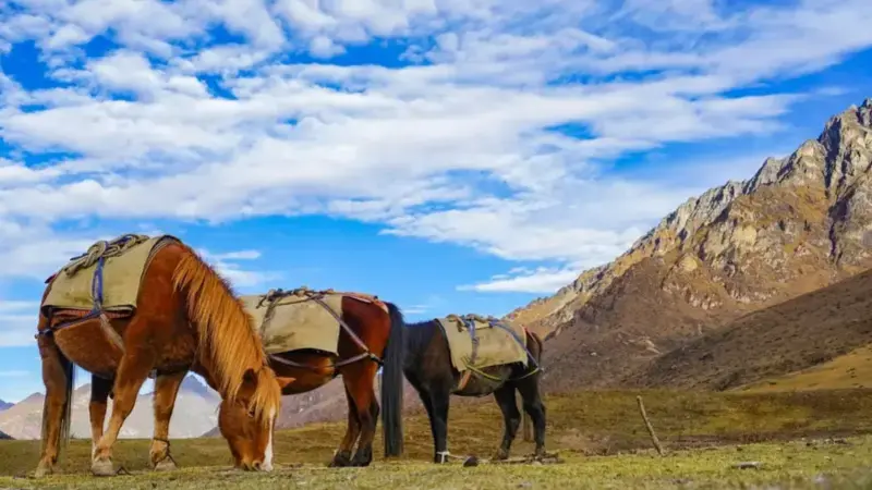
- Pack horses or mules for equipment transport
- Horse handlers (sirdars)
- All camping equipment (tents, dining tent, kitchen tent)
- Bhutan Tourism Visa and SDF (Sustainable Development Fee)
- Trekking permit and Jigme Dorji National Park fees
- Emergency evacuation plan and first aid kit
- Airport transfers and all ground transport
- International flights to/from Paro (PBH)
- Travel and medical insurance (strongly recommended)
- Personal trekking gear and clothing
- Sleeping bag (can be rented locally)
- Alcoholic beverages and personal snacks
- Tips for guides, cooks, and horse handlers
- Personal expenses and souvenirs
- Costs arising from itinerary changes due to weather or health
Essential Tips for the Jomolhari Trek
The Jomolhari Trek is a challenging multi-day high-altitude route. Begin cardio and leg-strength training at least 8–12 weeks before departure. Practice hiking with a loaded day pack on hilly terrain. You don't need to be an elite athlete, but solid base fitness makes the experience far more enjoyable.
The trek reaches 4,890m at the Nyele La pass. Spend at least one full day acclimatising in Paro (2,280m) before starting, and do not rush the ascent. Drink 3–4 litres of water daily. If you experience severe headaches, nausea, or confusion, descend immediately. Consult your doctor about acetazolamide (Diamox) before travelling.
Essentials include: layering system (thermal base, fleece mid-layer, waterproof shell), warm hat and gloves, trekking poles (essential on the steep descents), broken-in waterproof boots, a warm sleeping bag rated to at least -10°C, sunscreen SPF 50+, lip balm, and a quality headlamp with spare batteries.
Spring (April–June) and autumn (September–November) are the two prime windows. Autumn offers the clearest skies and most stable weather — ideal for photography. Spring brings rhododendrons in bloom on the lower slopes and slightly warmer temperatures. The trek is closed in monsoon (July–August) and the high passes are often snowbound in winter.
All trekking in Bhutan requires a licensed tour operator — independent trekking is not permitted. Your operator (Found Bhutan) handles the Bhutan Tourism Visa, Sustainable Development Fee, trekking permit, and Jigme Dorji National Park entry permit. Allow at least 2–3 weeks lead time for visa processing before your travel date.
Mobile coverage disappears after the first day of trekking. Download offline maps (Maps.me or Gaia GPS) before departure. Your Found Bhutan guide carries a first aid kit and has emergency evacuation protocols. Comprehensive travel insurance that covers high-altitude trekking and emergency helicopter evacuation is essential — do not trek without it.
Ready to Trek to Jomolhari?
Book Your Jomolhari Trek
with Found Bhutan
Our expert guides have led hundreds of trekkers to Jomolhari Base Camp. Every detail — permits, camps, meals, safety — is handled so you can focus entirely on the mountains.