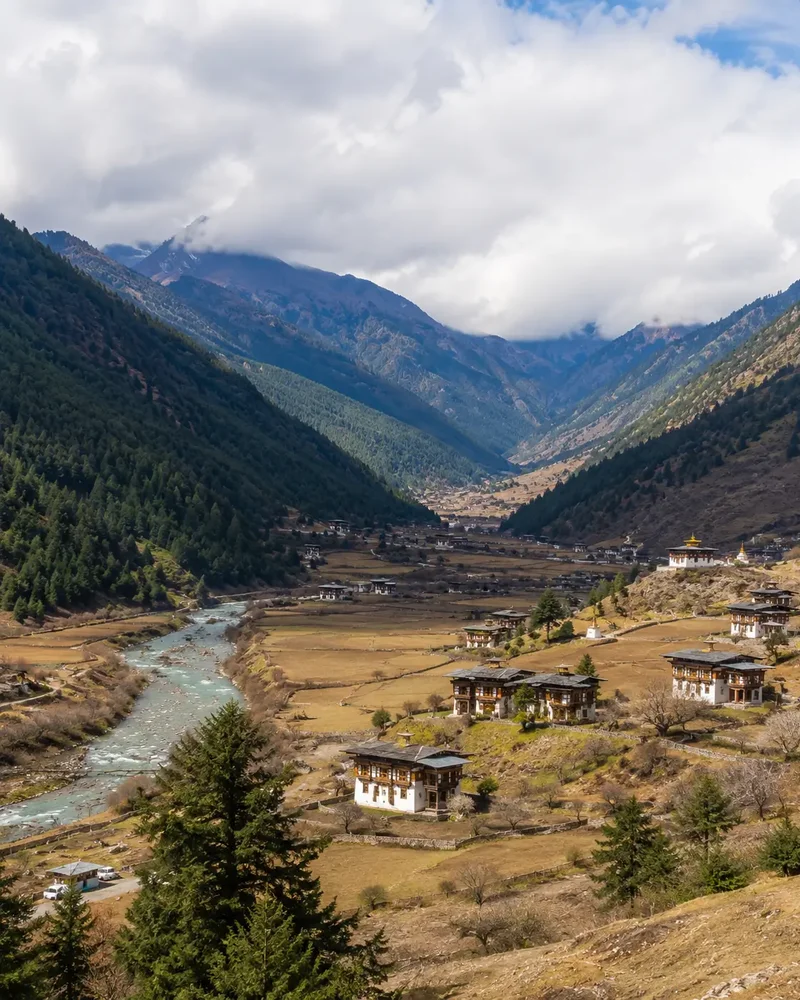
Haa – Nub Tshona Patta
Rigona Trek
Haa Valley, Western Bhutan
Seven Passes to a Sacred Lake
Haa valley sits at an average altitude of around 2,740m in western Bhutan and has only recently opened to trekkers. This route starts near Haa town, heads east for three days to the sacred lake Nub Tshona Patta, and returns over three more days via Rigona Tsho and a different string of passes — seven crossings in total, ranging from around 3,900m to 4,256m.
Haa is the ancestral home of the Dorji family, from whom Bhutan's Queen Mother descends, and the valley carries the legend of Terton Sherab Mebar and his conflicts with the deities said to guard its lakes. Expect high pastureland, yak herders, and — on clear days — views stretching to Kanchenjunga, Jhomolhari, Jitchu Drake and Gangkar Punsum, the world's highest unclimbed peak.
Trek at a Glance
Key facts to plan around before you book.
Duration
6–7 days, including a rest day
Grade
Moderate–demanding
Passes crossed
Seven, from ~3,900m to 4,256m
Start / End
Kajenang village to Lukha, near Haa town
Best season
Check locally — a newly opened, weather-exposed high route
Highlights
Nub Tshona Patta lake, Himalayan viewpoints, high pastures
Itinerary
Day by Day
The trek begins near Kajenang village in Haa valley, climbing first to Dragnag Dhingkha lhakhang before continuing up to the first camp at Tsokam.
A gradual ascent on a good trail crosses two passes, Chozu La and Tsabjo La, passing the large Yulo meadow — the last camp on the return leg — where several trails converge. Camp is pitched at Wanjithang in a broad pasture area.
High pastureland grazed by yaks leads to Gongche La, the first pass, followed by a steep descent to Chhosho Lumpa meadow and a second climb to Tsejey La — with, on a clear day, views to Kanchenjunga, Gankar Punsum and Jitchu Drake. Camp is set at Lura, above the holy lake of Nub Tshona Patta.
A rest and exploring day above the sacred lake — a recommended pause before the second half of the circuit, and a chance to acclimatise properly at altitude.
The route turns north, crossing Dong Kacheydo La with views toward Kanchenjunga, then descending to camp near the lake Rigona Tsho.
The hardest start of the trek: a rocky climb to Bjara La, the highest pass of the route, with — weather permitting — views of Jhomolhari and Jitchu Drake to the north. A second pass, Tsabjo La-north, leads back to the familiar Yulo meadow, closing the loop of the outward route.
A long final descent through silver fir and pine forest brings the trek to a close at Lukha village, close to Haa town.
Permits & Practicalities
Licensed Guide, Always
A licensed Bhutanese guide accompanies the trek start to finish, as on every route in the country.
Newly Opened Route
Haa's trekking routes have only recently opened to visitors — confirm current status and any restricted sections with your operator before booking.
High-Altitude Fitness
Seven passes above 3,900m make this one of the more demanding treks in western Bhutan — good acclimatisation and fitness matter more than trail difficulty alone.
Customise Your
Bhutan Tour Today
Fill in the form and our expert team will get back to you within 24 hours.