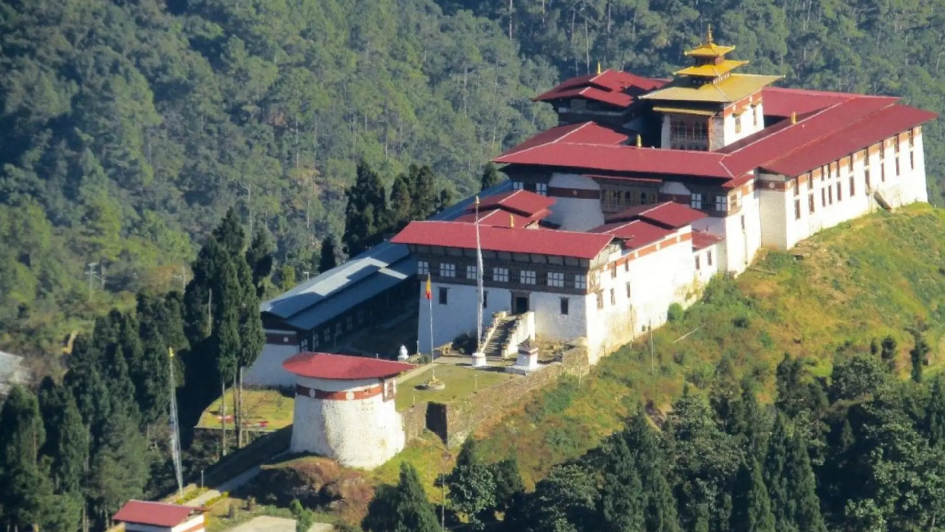
Dagana, Bhutan
The Realm of White Prayer Flags · South-Central Bhutan
The Realm of White Prayer Flags
Dagana takes its name from the Dzongkha for "white silk scarf" (dar dkar na) — according to legend, the site for its dzong was marked by one. The dzong's alternative name, Darkanang, means "the Realm of White Prayer Flags," and it's a fitting identity for a district that sits in the transitional zone between Bhutan's high interior and the subtropical southern foothills, ranging from around 300 metres in the south to over 3,800 metres in the north.
This is genuine frontier country. Dagana played a direct role in the 1864–65 Duar War between Bhutan and British India, the conflict that ended with the Treaty of Sinchula and Bhutan permanently ceding the lowland Duars plains. Standing at Dagana Dzong today means standing at the fortress that once defended exactly this border — a piece of Bhutanese history with real stakes, not just a scenic ruin.
Both Ngalop (Dzongkha-speaking) and Lhotshampa (Nepali-speaking) communities call Dagana home, and roughly 80% of the district remains under forest cover. It's rarely visited by international travellers, making it one of southern Bhutan's more genuinely off-the-radar destinations.
Must-See Places in Dagana
A frontier fortress with sacred relics, three founding megaliths, and a direct connection to Bhutan's history with British India.
Dagana Dzong
Built in 1651 by Dronyer Druk Namgyel under the direct command of Zhabdrung Ngawang Namgyal, Dagana Dzong was raised to defend the southern approaches to the Bhutanese heartland from the lowland states of present-day Assam and West Bengal. Its name — and alternative name, Darkanang, "the Realm of White Prayer Flags" — trace back to the legend of a white silk scarf marking the founding site.
The Buffalo Horn & Founding Megaliths
Among Dagana Dzong's most precious relics is a sacred buffalo horn measuring 4 feet 5 inches, believed to have been discovered by Daga Penlop Tempa Thinley in the early 16th century. The dzong also holds three ancient megaliths tied to its founding legend: Do Namkhai Kaw (the sky pillar rock), Do Kelpai Genthey (the rock of ancient steps), and Tha Namkhai Dzong (the frontier sky fortress).
The Duar War Frontier
Dagana district was directly involved in the 1864–65 Duar War between Bhutan and British India. The conflict ended with the Treaty of Sinchula, under which Bhutan permanently ceded the lowland Duars plains — a defining moment in the country's modern territorial history, and one that gives Dagana Dzong a particular weight as the fortress that once stood on this exact frontier.
Dagana Tshechu
Held each September or October at Dagana Dzong, this festival brings together the district's Ngalop and Lhotshampa communities in their finest traditional dress — a visual and cultural mix specific to south-central Bhutan's mixed-ethnicity districts. Cham dances in the Drukpa Kagyu tradition close with the unfurling of the Thongdrel on the final day.
Getting to & Around Dagana
Getting There
Dagana is roughly 252 km from Thimphu, reached via winding roads through south-central Bhutan's rugged, river-dissected terrain. It borders Tsirang to the east, Chukha to the west, and Wangdue Phodrang to the north, making it a natural stop for travellers linking a wider southern Bhutan circuit.
Where to Stay
Accommodation in Dagana is limited and basic, reflecting how rarely international travellers visit. Most itineraries treat it as a stop along a broader southern route rather than a dedicated multi-night base.
Weather & Best Time
September and October bring the Dagana Tshechu along with the tail end of the monsoon clearing into more settled weather. October through March generally offers the driest, most comfortable conditions for travel through the district's dissected river valleys.
A Heavily Forested District
With roughly 80% of Dagana under forest cover and elevations ranging from 300m to over 3,800m, the district offers dramatic landscape variety in a small footprint — worth building into any itinerary focused on rural, less-visited Bhutan.
Ready to Experience Bhutan?
Let Found Bhutan Plan
Your Perfect Journey
Every itinerary we craft is personalised, expertly guided, and designed to give you deeper access to Bhutan's magic than any standard tour.
Festivals in Dagana
The Dagana Tshechu unites the district's Ngalop and Lhotshampa communities at a fortress that once defended Bhutan's southern frontier.
View All Bhutan Festivals & Dates →