Tsirang, Bhutan
Orange Orchards & Gentle Hills · Southern Bhutan
Bhutan's Most Culturally Layered District
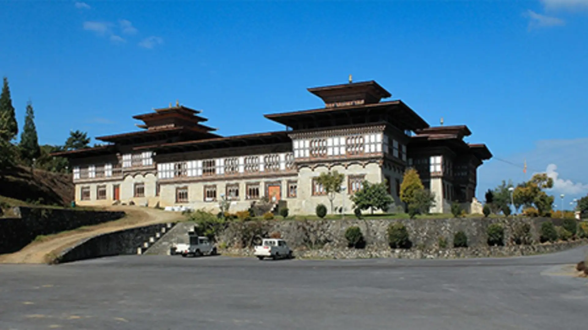
Tsirang sits along the Wangdue–Gelephu highway in south-central Bhutan, a district of gentle subtropical slopes and a notably mild climate compared to the high valleys further north. Its administrative centre, Damphu, is home to Tsirang Dzong and one of the most striking features of the district: an active, everyday coexistence of Buddhist and Hindu tradition, visible in the Hindu-Buddhist temple in the heart of town.
The district's population of around 22,000 is one of Bhutan's most ethnically diverse, made up of Lhotshampa communities — Nepali speakers including Bhujel, Magar, Tamang, Gurung, Limbu, and Rai subgroups — alongside Dzongkha-speaking Ngalop communities in the north. Fertile slopes produce paddy, maize, millet, oranges, and cardamom, making Tsirang one of the more agriculturally productive districts in southern Bhutan.
Unusually for Bhutan, Tsirang has no dedicated protected area of its own — only its northernmost reaches fall within Jigme Singye Wangchuck National Park — but it remains rich in biodiversity, anchored by the Pemachoeling Heritage Forest and the Sankosh (Punatsang Chhu) river that runs through the district. Tsirang receives very few international visitors, and travellers who do make it here find one of Bhutan's most genuinely under-the-radar corners.
Must-See Places in Tsirang
Gentle hills, orange orchards, and a genuine blending of two faiths make Tsirang one of southern Bhutan's most distinctive, least-visited districts.
Tsirang Dzong, Damphu
Tsirang Dzong stands in Damphu, the district's administrative centre on the Wangdue–Gelephu highway. It's the venue for the annual Tsirang Tshechu and the natural anchor point for a visit to the district, surrounded by the gentle, mild-climate hills that distinguish Tsirang from higher-altitude Bhutan.
Namgyel Chholing Rabdey Dratshang
The district's monastic body and the venue for its ongoing religious rituals, Namgyel Chholing Rabdey Dratshang plays a central role in Tsirang's spiritual life beyond the annual Tshechu, and is worth combining with a visit to the dzong.
Pemachoeling Heritage Forest
A sanctuary of rare and endangered species and a sacred site layered with local legend, Pemachoeling Heritage Forest is dotted with goempas and chortens and represents one of Tsirang's richest pockets of biodiversity — notable given the district has no dedicated national park of its own.
Hindu-Buddhist Damphu
At the centre of Damphu stands a temple where Hindu and Buddhist practice coexist — a physical expression of Tsirang's layered religious identity, and one of the more distinctive cultural sights in a district where both traditions are actively and visibly practised side by side.
Tsirang Tshechu
Held at Tsirang Dzong, this three-day festival is the most significant annual gathering in the district, bringing together its diverse Lhotshampa and Ngalop communities for Cham dances, religious rituals, and a closing Thongdrel unveiling. Lhotshampa folk songs and dances sit alongside Buddhist ceremonial performances — the district's cultural layering visible in a single festival ground. Tsirang receives very few international visitors, making this one of Bhutan's most authentic Tshechus.
Getting to & Around Tsirang
Getting There
Tsirang lies on the Wangdue Phodrang–Gelephu highway. The drive from Wangdue is scenic, passing the large Punatsangchu hydropower project under construction along the Puna Tsang Chhu, before climbing through orange orchards and paddy terraces into Damphu.
Where to Stay
Accommodation in Tsirang is limited, reflecting how few tourists visit. Most itineraries treat it as a stop along the Wangdue–Gelephu road rather than a dedicated multi-night base, though simple local lodging is available in and around Damphu if your operator recommends staying.
Weather & Best Time
Tsirang's mild subtropical climate is gentler than much of Bhutan year-round. October through March brings the most comfortable, driest conditions, while the June–September monsoon brings heavier rain typical of the southern foothills.
A District Built on Agriculture
Tsirang's fertile slopes make it one of southern Bhutan's more productive farming districts, known for oranges, cardamom, paddy, maize, and millet. Travelling through in season, the hillsides of orange trees are one of the most memorable visual features of the drive.
Ready to Experience Bhutan?
Let Found Bhutan Plan
Your Perfect Journey
Every itinerary we craft is personalised, expertly guided, and designed to give you deeper access to Bhutan's magic than any standard tour.
Festivals in Tsirang
The Tsirang Tshechu brings the district's Lhotshampa and Ngalop communities together at Tsirang Dzong.
View All Bhutan Festivals & Dates →