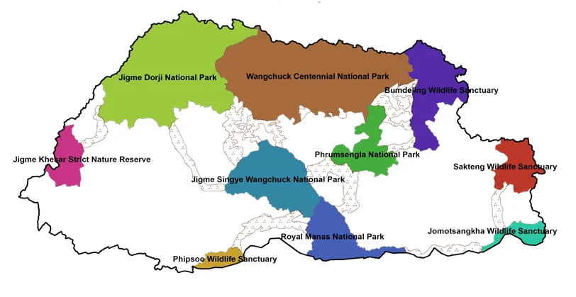
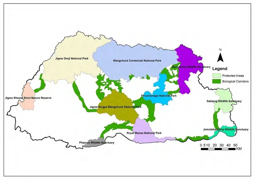
Jigme Dorji National Park covers 4,316 square kilometres of northwestern Bhutan - the country's second-largest protected area, and until 2008 it’s the largest. Inside its boundaries: 36-37 recorded species of mammal, 328 recorded species of bird, 376 glaciers, and the only confirmed place on Earth where wild Bengal tigers and snow leopards share the same forested slopes - a fact Bhutan's own government cites as the park's single most scientifically significant feature.
Most visitors never see it the way the name suggests. There is no gate, no visitor centre and no jeep safari. Bhutan's approach to Jigme Dorji is the same as its approach to almost everything else: protect first, then let people in on the country's own terms - on foot, with a licensed guide, along some of the most demanding and rewarding trekking routes in the Himalaya.
This guide is built from Bhutan's own primary sources - the park's UNESCO World Heritage nomination document, the government's Bhutan for Life conservation trust, and the national biodiversity portal - rather than repeating the recycled, and often incorrect, figures that circulate across most travel blogs on this topic. It covers what the park actually is, what lives inside it, how its four trekking routes differ, and how to experience a genuine slice of it without three weeks of camping above 4,000 metres.
Bhutan's national animal, national flower, national bird and national tree all occur together in exactly one place in the country. This is it.
What Is Jigme Dorji National Park?
Jigme Dorji National Park (JDNP) is named after Jigme Dorji Wangchuck, the third king of Bhutan, and was gazetted in 1974 as a wildlife sanctuary covering much of the country's northern strip. In 1993, when Bhutan overhauled its entire protected area system, the sanctuary was upgraded to national park status and its boundary was substantially reduced, confining it to the mountainous northwest it occupies today; park staff were deployed to manage it from 1995. Until Wangchuck Centennial National Park was established in 2008, JDNP was Bhutan's single largest protected area - it is now the second largest.
| Fact | Detail |
|---|---|
| Area | 4,316 km² (1,666 sq mi) |
| Size rank | Second-largest national park in Bhutan; largest until Wangchuck Centennial National Park (4,914 km²) was created in 2008 |
| Established | Gazetted 1974 as a wildlife sanctuary; upgraded to national park status in 1993; staffed from 1995 |
| Named after | Jigme Dorji Wangchuck, Bhutan's third Druk Gyalpo |
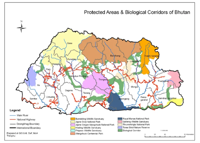
| Administration | 5 dzongkhags (almost all of Gasa, plus northern Thimphu, Paro, Punakha and Wangdue Phodrang) across 15 gewogs; run from 5 park range offices and 1 sub-range office |
| Elevation range | Roughly 1,400 m to 7,326 m (the summit of Mount Jomolhari); Bhutan's own UNESCO submission cites the inhabited/vegetation band as 1,600-7,100 m |
| Resident population | Approximately 6,000 people (cited as 5,950-6,500 depending on source and year) in around 1,000 households |
| Glaciers | 376 glaciers - roughly 42% of every glacier in Bhutan |
| UNESCO status | On Bhutan's UNESCO World Heritage Tentative List since 8 March 2012 |
Where Is Jigme Dorji National Park, and How Do You Get There?
The park sits in Bhutan's far northwest, its northern edge running along the border with Tibet. It occupies nearly the entire Gasa District and reaches south into the upper, mountainous portions of Thimphu, Paro, Punakha and Wangdue Phodrang districts - meaning a surprising amount of western Bhutan's most-visited valleys technically border, or briefly enter, the park.
For non-trekkers: the Dodena entry point
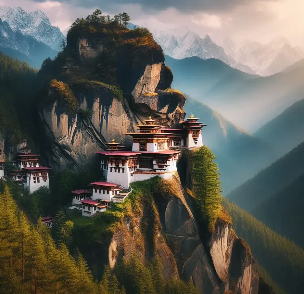
The easiest way to genuinely set foot inside Jigme Dorji National Park doesn't involve a tent. From Thimphu, a roughly 30-minute drive north up the valley brings you to Dodena, right at the park's southern boundary. From here, a gentle riverside trail leads to Cheri Monastery (founded in 1620 by the Zhabdrung) and the Tango Monastery area - both comfortably done as a half-day walk, with no trekking permit, no camping, and no separate booking beyond your normal guided itinerary.
For trekkers: Paro, Punakha and Gasa
Every trekking route into the park's interior begins from one of two directions: north out of Paro (for the Jomolhari routes), or via Punakha and the town of Gasa (for the Laya-Gasa, Lunana and Snowman routes). The Punakha-Gasa road is now paved for most of its length, cutting the drive to roughly four to five hours; beyond Gasa, the road gives way to the trail network your guide and pack animals will use for the remainder of the journey.
Wildlife: What Actually Lives in Jigme Dorji National Park
According to Bhutan's own UNESCO nomination document, JDNP holds more than 36 recorded species of mammal, 5 reptiles, 39 butterflies, 328 birds and 1,450 vascular plants - and the government states plainly that it is the only park in the world where the ranges of the Royal Bengal tiger and the snow leopard are documented to overlap. Within that overlap sits an even more specific record: a Bengal tiger was recorded here at 4,200 metres above sea level, the highest elevation a tiger has ever been confirmed at across every tiger-range country on Earth.
- Snow leopard, Bengal tiger, clouded leopard and common leopard, all present though rarely seen
- Takin - Bhutan's national animal; JDNP holds the country's largest population
- Himalayan blue sheep (bharal), red panda, Himalayan black bear, musk deer and Ussuri dhole
- Himalayan serow, goral, sambar and barking deer
- 328 recorded bird species, including two exceptionally rare ones: the white-bellied heron (critically endangered, among the rarest birds on Earth) and the black-necked crane (vulnerable)
JDNP is also the only park in Bhutan where all four national symbols coexist: the takin (national animal), the blue poppy (national flower), the raven (national bird) and the cypress (national tree).
Jigme Dorji National Park does not offer wildlife safari in any conventional sense. There are no game drives, no viewing vehicles and no near-guaranteed sightings. What's on offer instead is guided nature walks, birdwatching, and the genuine chance - not the certainty - of spotting blue sheep, marmots or raptors along a trekking route. Snow leopard and tiger sightings are exceptionally rare even for people who spend weeks in the park.
The Sacred Mountains: Jomolhari, Jichu Drake and Bhutan's Climbing Ban
Mount Jomolhari (also spelled Chomolhari), at around 7,326 metres, straddles the Bhutan-Tibet border at the park's northern edge and is the highest point within JDNP. Known as "the Bride of Kangchenjunga," it is sacred to Tibetan Buddhists as the abode of one of the five Tsheringma sister-goddesses, and a small temple sits on its southern flank at around 4,150 metres. Its neighbouring peak, Jichu Drake, rises to roughly 6,662 metres, and trekking routes through the park also pass beneath Masangang and Gangla Karchung, with Gangkhar Puensum - Bhutan's highest peak, in the neighbouring Wangchuck Centennial National Park - visible from some of the higher passes.
None of these peaks has been climbed in decades, and none will be. Bhutan restricted mountaineering above 6,000 metres in the mid-1990s out of respect for beliefs that the high peaks are the homes of protective deities, then extended this to a complete ban on climbing any mountain in the country in 2003. Gangkhar Puensum, at 7,570 metres, is generally cited as the world's highest unclimbed mountain - but the same law and the same reasoning apply to every peak inside Jigme Dorji itself.
Glaciers, Rivers and a Warming Climate
JDNP contains 376 glaciers - by the Bhutan for Life trust's own count, roughly 42% of every glacier in the country - making it by far the most heavily glaciated national park in Bhutan. Several of its glacial lakes, including Thorthormi, Luggye and Teri Kang in the remote Lunana region, are classified as high risk for glacial lake outburst floods (GLOFs) as warm temperatures accelerate melting. The Bhutanese government has run lake-lowering and monitoring projects in this exact area for years, precisely because the communities and trekking routes below sit in the flood path; the Kholong river in particular is flagged by Bhutan for Life as a recurring flash-flood risk despite efforts to control it.
The park is also the watershed for four of western Bhutan's major rivers - the Pa Chhu (Paro Chhu), Wang Chhu, Pho Chhu and Mo Chhu - all of which feed major hydropower stations downstream. That makes JDNP not just an ecological asset but a genuine piece of national infrastructure: a meaningful share of Bhutan's electricity, and export revenue from electricity sold to India, ultimately originates as glacial melt and rainfall inside this park.
Trekking in Jigme Dorji National Park
As with everywhere in Bhutan, independent trekking is not permitted. Every route through JDNP is fully guided and camp-based - tents, cooks and pack animals (yaks, horses or mules depending on the terrain) carry everything, since there are no teahouses of the kind found on Nepal's popular routes. Four named routes cover almost all trekking traffic through the park, and they are not interchangeable.
Jomolhari Trek - the classic introduction
The most popular route in the park, and Bhutan's most famous trek overall. The shorter Jomolhari Loop runs 4-5 days out of Paro; the longer classic version continues 8-9 days through to Thimphu via the Nyile La and Yeli La passes (both around 4,870 m). Either way, the highlight is two nights at Jangothang base camp (around 4,040 m), directly beneath Jomolhari and Jichu Drake.
Laya-Gasa Trek - culture, then a hot spring
A longer, quieter route of roughly 13-16 days that shares its opening days with the Jomolhari trail before continuing north through Lingshi and on to Laya, Bhutan's highest permanent settlement at 3,820 metres and home to the Layap people, distinctive for their conical bamboo hats and semi-nomadic yak-herding life. The trek descends from Laya to the town of Gasa, where Gasa Tshachu - a set of natural hot springs - is the traditional, well-earned finish.
Lunana Trek - the shorter way into the far north
A less commonly marketed variant that pushes past Laya into the remote Lunana region - the heart of the Snowman route - before turning back or exiting, rather than continuing the full distance to Bumthang. It's the option for trekkers who want Lunana's genuine remoteness and glacial scenery without a full 24-plus-day commitment, and it's worth asking your operator about directly, since it isn't marketed as heavily as the other three.
Snowman Trek – Also referred as the world's hardest trek
An extension of the Laya-Gasa route deep into Lunana and on to Bumthang, running 24-30 days depending on pace and weather, and widely described by trekking operators and outlets like National Geographic as the toughest trek in the world. It crosses more than ten passes above 4,500 metres – with Gophu La, at roughly 5,230 metres, as the single highest point on the route - with camps that themselves sit above 5,000 metres for multiple nights. Reported non-completion rates run as high as 50%, driven by altitude illness and early snow closing the high passes; fewer than a few hundred people attempt it in a typical year.
| Trek | Duration | Highest Point | Best For |
|---|---|---|---|
| Jomolhari Loop | 4-5 days | ~4,890 m | First-time Himalayan trekkers wanting mountain views without a long commitment |
| Jomolhari (classic) | 8-9 days | ~4,870 m | Moderately experienced trekkers wanting more remote villages and passes |
| Laya-Gasa | 13-16 days | ~4,900 m+ | Trekkers who want culture and wilderness in equal measure, ending in a hot spring |
| Lunana | ~18-20 days | ~5,000 m+ | Trekkers wanting Lunana's remoteness without the full Snowman distance |
| Snowman | 24-30 days | ~5,230 m (Gophu La) | Experienced, well-prepared high-altitude trekkers only |
Best Time to Visit Jigme Dorji National Park
Spring and autumn bracket the trekking season, and for good reason - Bhutan's high passes are simply impassable, or unsafe, outside these windows.
- Spring (March-May): rhododendrons and blue poppies in bloom lower down, clear mountain views, good conditions for the Jomolhari routes
- Autumn (September-November): the most stable weather of the year and the best window for the high passes on the Laya-Gasa, Lunana and Snowman treks; the Royal Highland Festival takes place in Laya on 23-24 October
- Winter (December-February): high routes are closed by snow, but Dodena and the lower valleys near Thimphu remain accessible
- Monsoon (June-August): heavy rain, leeches on lower trails, and real risk on the high passes - not recommended for any of the major treks, though it is cordyceps-harvesting season for local communities
For the Royal Highland Festival specifically, book the trek to Laya at least six months out. Accommodation in Gasa fills fast around the festival dates, and the trail itself gets genuinely busy for those two days - one of the only times you'll share a JDNP trekking route with a crowd.
Permits, Guides and the Sustainable Development Fee
Every foreign tourist in Bhutan pays the Sustainable Development Fee (SDF) - currently USD 100 per person, per night, a rate fixed until 31 August 2027 - arranged in advance through a licensed Bhutanese tour operator as part of the visa process. A 5% goods and services tax introduced in January 2026 applies to in-country tour services such as hotels and guides, but not to the SDF itself, which stays flat.
Inside Jigme Dorji National Park specifically, three additional rules apply on top of the standard SDF and visa process:
- A licensed trekking guide (not just a usual cultural guide) is mandatory for every trekking route and for visits to any monument or religious site - there is no self-guided trekking option anywhere in Bhutan
- Laya, Lingshi and the Lunana region sit within a restricted area, requiring an additional route permit that your tour operator arranges alongside your visa
- There is no separate, ticketed park entrance fee of the kind found at many national parks elsewhere - access is bundled into your guided tour arrangement
On the ground, the park is patrolled by roughly 50-armed rangers operating out of its five range offices and one sub-range office - one of the reasons Bhutan for Life singles out JDNP's anti-poaching and SMART-patrolling programmes as a funding priority.
Culture and Communities Inside the Park
Around 6,000 people live inside JDNP's boundaries, most sustained by subsistence farming below 4,000 metres and semi-nomadic yak herding above it. What's easy to miss is that this isn't one culture: Bhutan's own UNESCO submission specifically notes that the people of Laya, Gasa, Lunana and the Tamidamchu-Chhubu area each maintain distinguishably different dialects and customs, shaped by centuries of relative isolation from one another inside the same park.
Laya is the best-known of these communities - the highest permanent settlement in Bhutan at 3,820 metres, and home to the Layap people, whose women wear a distinctive pointed hat woven from darkened bamboo. Each October to November, Laya hosts the Royal Highland Festival, a two to three-day celebration of highland life featuring yak and horse competitions, traditional Layap song and dance, and the 25-kilometre Laya Run. Elsewhere in the park, the historic fortresses of Lingshi Dzong and Gasa Dzong mark centuries-old administrative centres.
JDNP is also, by Bhutan's own account, the national park with the largest number of hot springs and medicinal baths in the country - geothermal sites are found not only at the well-known Gasa Tshachu but also at Tsharijathang, Chubu and Khoma. Community involvement runs deeper than tourism, too: around eight Community Forests currently operate inside the park, giving local households a formal, government-recognised role in managing the resources they depend on.
Can You Visit JDNP Without Trekking?
Yes - and this is worth knowing before assuming JDNP is only for serious trekkers. Two options give a genuine sense of the park without weeks of camping:
- The Dodena trailhead near Thimphu, covered above, for a half-day walk to Cheri and Tango monasteries inside the park's southern boundary
- Gasa Dzong and Gasa Tshachu, both reachable by road from Punakha in under half a day, giving access to the park's historic and thermal-spring highlights without a single night at altitude
Conservation, and Why This Park Matters
JDNP forms a critical link in Bhutan's biological corridor system, connecting directly to Wangchuck Centennial National Park to the east and, on a much larger scale, providing crucial connectivity to the Kangchenjunga Conservation Complex spanning northeast India and eastern Nepal. That transboundary connectivity is precisely why wide-ranging species like tigers and snow leopards can move across an unbroken swath of protected habitat rather than being isolated in a single reserve - and why their ranges overlap here in the first place.
Bhutan is constitutionally required to maintain at least 60% forest cover in perpetuity and is one of the world's only carbon-negative countries - absorbing more carbon than it emits. Bhutan for Life, the government's dedicated conservation financing trust, channels long-term funding into JDNP for exactly the threats its own risk assessments identify: retreating glaciers, Kholong river flash floods, poaching (park staff dismantle hundreds of animal traps every year), litter left by loggers and cordyceps collectors, and habitat degradation from road construction. Its stated goals for the park include increased tiger and snow leopard populations, restored degraded land, and community-based insurance schemes that compensate farmers for livestock and crop losses to wildlife - an acknowledgment that conservation here only works if it doesn't come at the local community's expense.
Frequently Asked Questions
Is Jigme Dorji the largest national park in Bhutan?
Not anymore. It was Bhutan's largest until 2008, when Wangchuck Centennial National Park (4,914 km²) was established. JDNP, at 4,316 km², is now the second largest.
Can you visit Jigme Dorji National Park without trekking?
Yes. The Dodena trailhead near Thimphu offers a half-day walk into the park's southern edge, and Gasa Dzong and Gasa Tshachu hot springs are reachable by road from Punakha without any overnight trekking.
Will you see wildlife like snow leopards or tigers?
Almost certainly not those two specifically - sightings of snow leopards and tigers are exceptionally rare, even for guides who have worked in the park for decades. Blue sheep, marmots, pheasants and raptors are realistic sightings on most trekking routes.
Do you need a special permit to enter Jigme Dorji National Park?
You need the standard Bhutan visa and Sustainable Development Fee arranged through a licensed tour operator, plus a mandatory licensed trekking guide for any trekking or monument visit. Laya, Lingshi and Lunana additionally require a restricted-area route permit, which your operator arranges alongside your visa.
What is the best trek in Jigme Dorji National Park for a first-timer?
The Jomolhari Loop (4-5 days) is the standard recommendation: it reaches Jangothang base camp beneath Mount Jomolhari without the altitude exposure or duration of the Laya-Gasa, Lunana or Snowman routes.
How many glaciers does Jigme Dorji National Park have?
376, according to the Bhutan for Life conservation trust - around 42% of every glacier in the country, making JDNP by far Bhutan's most heavily glaciated national park.
Is Snowman Trek really the hardest trek in the world?
It's widely described that way by trekking operators, mountaineering journalists and outlets including National Geographic, based on its combination of altitude (multiple nights and passes above 5,000 m), duration (24-30 days), remoteness, and a reported non-completion rate as high as 50%.